We are reader-supported. When you buy through links on our site, we may earn affiliate commission.
You might have heard El Niño and La Niña on the news and wondered what they really mean for the weather. These Spanish-named events are climate patterns in the Pacific Ocean that influence rainfall, temperature, and storms worldwide. Both El Niño and La Niña are opposite stages of the same cycle, the El Niño-Southern Oscillation (ENSO). Meteorologists track them months in advance to predict droughts, floods, and major shifts in seasonal temperatures.
ENSO is a natural phenomenon that connects the ocean and atmosphere in the tropical Pacific. It reflects changes in air pressure and sea temperatures in this region. Normally, the east-to-west trade winds push warm surface water toward Indonesia and Australia. To replace that, colder, nutrient-rich water rises along the coast of Peru in a process called upwelling. This cycle supports fisheries by fertilizing the sunlit surface with organic matter from the deep ocean.
This occurrence keeps the eastern Pacific up to 14°F cooler, while waters near Indonesia rise by about 1.5 feet. The resulting thermal difference drives rainfall across the tropics. So when this balance shifts, the effects show up in weather patterns worldwide.
ENSO naturally occurs in irregular cycles, typically lasting two to seven years. It also shifts through three phases — neutral, El Niño, and La Niña. Scientists track the oscillation using changes in sea surface temperature (SST) at key locations. One of the most reliable indicators is the Niño 3.4 region.
If SSTs stay above a certain threshold for several months, it signals an El Niño. If the figures drop below that threshold, it indicates La Niña. Small changes in ocean temperature can move massive amounts of heat. That is why ENSO shapes weather far beyond the Pacific.
El Niño means “the boy” in Spanish, referring to the young Christ. Peruvian fishers first used the term centuries ago to describe unusually warm waters that reduced their Christmas catch.
During an El Niño event, the usual air pressure gradient that drives easterly winds weakens. Warm surface water in the central Pacific spreads eastward rather than being pushed westward. As a result, the normal upwelling of cold water off South America slows. Instead of rainfall around Indonesia, it now occurs in Peru and nearby countries.
The effects vary by region. In the United States, the wind shift brings wetter conditions to California and the Southern states. While this rainfall replenishes soil moisture, it can also raise flood risks in saturated areas. Northern states, on the other hand, often experience milder, drier winters. However, it can also worsen existing drought conditions.
In Peru and Ecuador, heavy downpour may trigger landslides and damage infrastructure. Meanwhile, equatorial Asia and parts of Australia can face heat waves and increased wildfire risk due to reduced rainfall.
Globally, El Niño tends to raise average surface temperatures. Remember the record-breaking warmth in 2023? Aside from the ongoing human-induced climate change, the year also experienced a strong El Niño event, which contributed to global heat rising roughly 2.12°F above the pre-industrial average.
El Niño is basically a major disruption to the Earth’s natural climate system. However, no two events are the same. Differences in timing and intensity mean impacts vary from year to year. A late-developing El Niño may affect a different growing season than one that peaks early, producing varied outcomes for agriculture, water supply, and ecosystems.
La Niña is the opposite phase of El Niño. The name means “the girl” in Spanish and refers to the cool phase of the ENSO cycle.
During La Niña, the trade winds strengthen. This pushes warm surface water farther west toward Indonesia and Australia. At the same time, upwelling intensifies along the coast of South America and cools the eastern Pacific more than usual. These stronger conditions amplify the normal climate occurrences across the region.
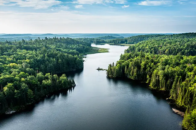
That shift in ocean temperature increases rainfall. Regions in Indonesia and Australia receive more moisture and stronger storms. For example, the 2024 to 2025 La Niña period brought precipitation about 36% above average in parts of Australia, which produced 12 tropical cyclones and widespread flooding in the northeast.
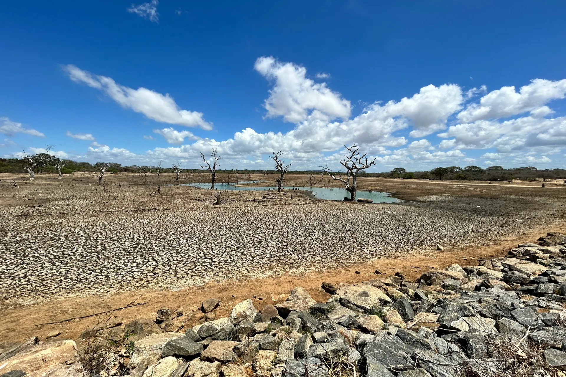
Meanwhile, the opposite pattern develops along the west coast of South America. Peru often experiences drier conditions as sinking dry air suppresses moisture. Countries such as Brazil, Argentina, and Uruguay may see reduced rainfall since all the water is channeled toward Asia. This affects crops, water supplies, and local economies.
The northern parts of South America respond differently. Areas including the Amazon Basin and Colombia often receive heavier rainfall. Colder-than-average Pacific water shifts atmospheric pressure patterns and alters the jet stream, which pushes moisture toward the northern part of the continent while leaving the south drier.
The U.S. also experiences a similar occurrence. La Niña brings storms and increased precipitation across the northern states. As a result, the southern United States tends to remain warmer and drier, raising the risk of drought. It also influences hurricane activity in the Atlantic. Stronger trade winds weaken the upper-level westerlies over the basin and reduce vertical wind shear, creating conditions that allow hurricanes to develop and intensify.
Most events last around nine months to a year, but some persist longer. A recent example was the triple-dip episode from 2020 to 2023, which continued for three consecutive years. Among the differences between the two is that La Niña lasts longer than El Niño. It often returns in back-to-back winters. Globally, La Niña tends to cool average surface temperatures.
Yes and no.
Researchers continue to examine how climate change interacts with the Earth’s atmospheric cycles. Whether it has already affected ENSO remains difficult to determine. The 2021 IPCC report concluded that there was no clear evidence yet of climate change influencing tropical Pacific SST anomalies. Human experience, however, often suggests otherwise.
More recent studies have found that the likelihood of ENSO variations has increased in amplitude by about 10% since 1960 due to rising greenhouse gas concentrations in the atmosphere. One sign of this stronger cycle is that major El Niño and La Niña events appear to be more intense and more frequent, which matches what scientists have observed in the historical record.
What is clear is that climate change can make ENSO impacts stronger, even if the basic behavior of the oscillation itself doesn’t change. The logic is straightforward — a warmer atmosphere can hold more moisture, so when the cycle shifts rainfall to a certain region, it can produce a heavier downpour than usual.
At the same time, warming from greenhouse gases can dry out soils, making ENSO-driven droughts more severe. The trapped gases also amplify the swings in sea surface temperatures, which in turn make ENSO stronger, and its effects are magnified even further.
To sum up, the difference between El Niño and La Niña is the ocean temperature and the trade winds. El Niño brings warmer-than-average waters and weak westerlies. Meanwhile, La Niña is characterized by cooler temps and stronger winds. The stark contrast in their impact reveals just how closely the ocean and atmosphere are connected. Together with land, these two powerful patterns shape much of the Earth’s identity as a blue planet. While naturally occurring, they influence rainfall and temperature, and evidence suggests human activity may amplify their effects.
Knowing these cycles helps communities, farmers, and decision-makers prepare for floods, droughts, or unusual seasons. Each event is unique, so historical patterns can only guide, not guarantee, what will happen next. Understanding ENSO then becomes less of a science and more about survivability on a warming planet.